

Broughton Heights [Pyked Stane Hill]
Good walks are even better shared.
NT1241 : Broughton Heights
Iain Russell Photo source
Overview
Broughton Heights [Pyked Stane Hill]
Nestled in the enchanting Southern Uplands, Broughton Heights, also known as Pyked Stane Hill, is a gem waiting to be explored. Standing tall at 630 meters, this Marilyn boasts impressive prominence and breathtaking views.
Geology
The mountain's geological composition is primarily of sedimentary rocks such as sandstone and siltstone from the Upper Old Red Sandstone period. These layers provide fascinating insights into the Earth's history—and a good excuse to stop and contemplate while breathing in that fresh Scottish air.
Routes
The suggested route is the Broughton Heights Circuit. Starting from the village of Broughton, this 7.5 km loop will take approximately three hours to complete. Expect a moderate difficulty that’ll make you feel accomplished without leaving you gasping for breath.
Summit Features
Once at the top, you'll be greeted by the proud trig point, which stands like a sentinel observing the surrounding landscape. It’s a perfect spot for a well-deserved rest and a snapshot to boast about.
Terrain Type
The ascent is a delightful mix of grassy slopes with the occasional rocky outcrop. This combination makes for an enjoyable hike, ideal for those who are looking to stretch their legs without grappling with challenging scrambles.
Views
One of the highlights of reaching the summit is the panoramic views it offers. On clear days, you can feast your eyes on the Moffat Hills, Tinto, and beyond to the Southern Uplands. The best time to capture these views is in spring or autumn, where the weather is generally more favourable.
Hazards
As with any Scottish hill, keep an eye on the weather; it can change quicker than you can finish your sandwich. Additionally, some sections can become slippery, particularly after rain, so tread carefully.
Access
Getting there is straightforward. The nearest parking can be found in the quaint village of Broughton. Local buses service this area, so check the schedule before your journey.
Facilities
While Broughton doesn't boast an array of amenities, there are a few charming cafes to recharge after your adventure, along with public toilets.
History
The name 'Pyked Stane' reflects the traditional use of stone markers in the area, while 'heights' serves to remind us of its impressive stature in the landscape.
Broughton Heights is more than just a hill; it's an experience. Whether you're a seasoned hiker or a casual walker, there's a little bit of everything to enjoy up there.
So grab your boots, pack your sense of adventure, and head off to explore Broughton Heights. You won't be disappointed!
Enjoy your hike!
Explore routes near Broughton Heights [Pyked Stane Hill]
Walks starting near this hill. Open a route to check its map, distance and full itinerary.
Peebles to Neidpath Castle: Tweed Riverside Walk
View route
Cademuir Forest Pilots Trail
View route
East Calder: Almondell, Mandela Bridge and River Almond Circuit
View route
Artists’ walk in Craigmillar Castle Park (group meeting)
View route
Route planning notes
These notes describe possible approaches. Check a route's map and access information when planning your walk.
Broughton Heights Circuit
A scenic loop starting from Broughton village, winding through rolling hills and offering diverse landscapes.
Make a day of it, together
Find someone to share the walk with, or organise a day out along a route you like.
Photo Gallery
View all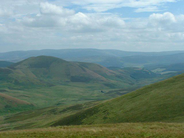 Photo could not load
NT1241 : Broughton Heights
Iain Russell
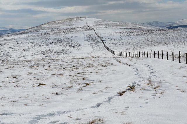 Photo could not load
NT1241 : Pyked Stane Hill from the north
Jim Barton
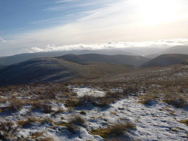 Photo could not load
NT1241 : Pyked Stane Hill
Alan O'Dowd
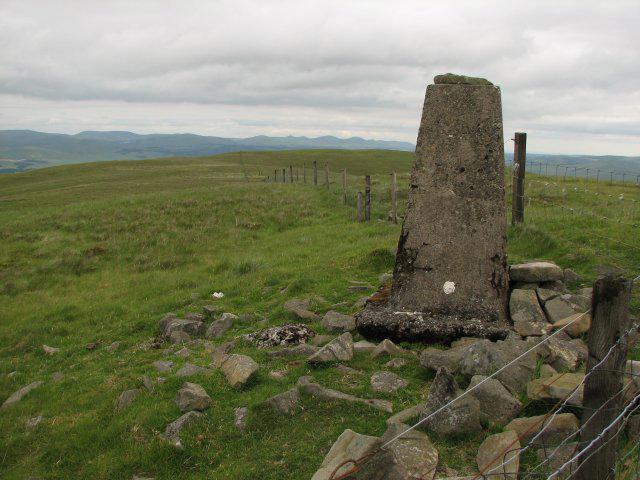 Photo could not load
NT1241 : Trig point, Pyked Stane Hill
Callum Black
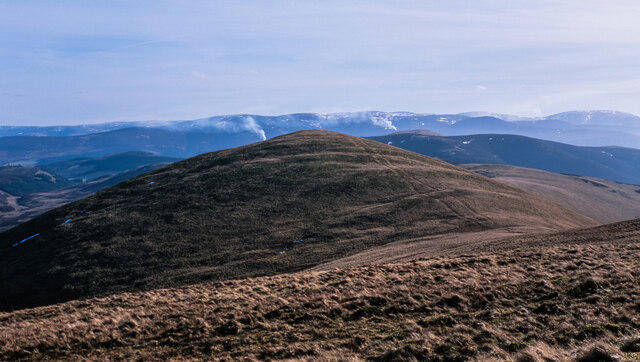 Photo could not load
NT1241 : South slope and ridge of Pyked Stane Hill
Trevor Littlewood
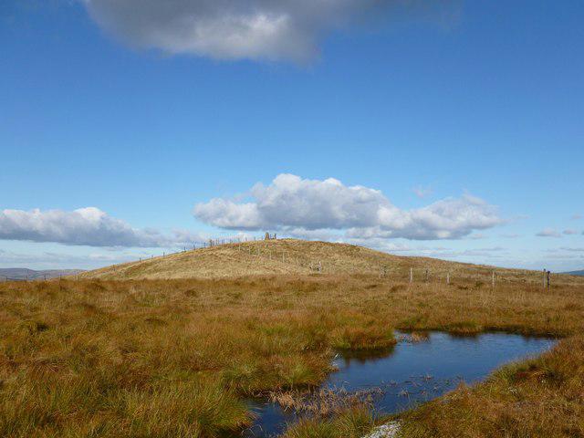 Photo could not load
NT1241 : Frozen Pool near summit of Pyked Stane Hill
Alan O'Dowd
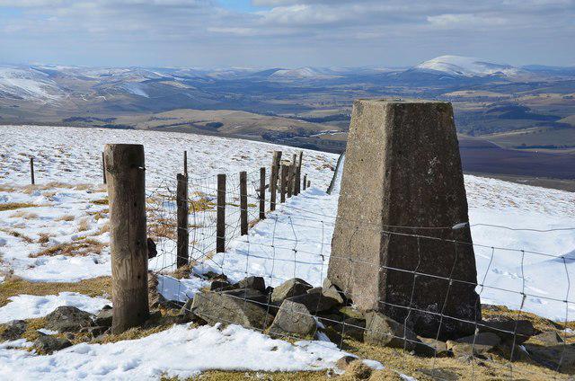 Photo could not load
NT1241 : Summit of Pyked Stane Hill, Broughton Heights (2)
Jim Barton
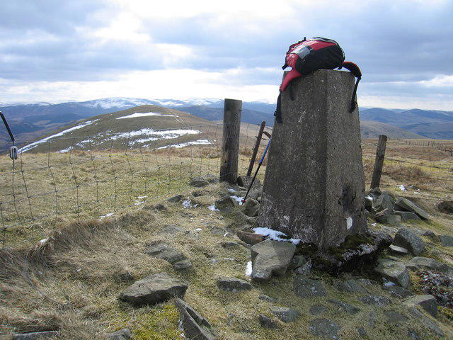 Photo could not load
NT1241 : Broughton Heights - Pyked Stane Hill
Rude Health
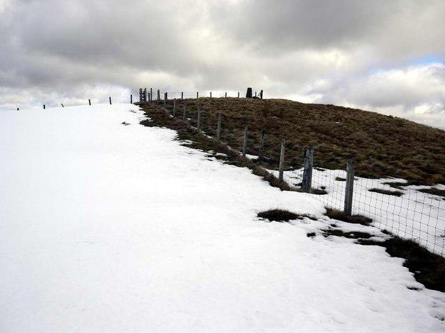 Photo could not load
NT1241 : Approaching the trig on Pyked Stane Hill
Gordon Brown
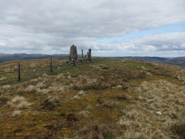
NT1241 : Broughton Heights
David Brown
Hill facts and local notes
Classifications
Elevation
571m
1,873 ft
Prominence
347m
Coordinates
55.6555, -3.3954
NT122411
OS Map
72
Explorer: 336
At the Summit
The summit boasts a prominent trig point, providing a perfect selfie spot for adventurers and amateur photographers alike.
Terrain & Geology
Broughton Heights predominantly features sedimentary rocks, including sandstone and siltstone from the Upper Old Red Sandstone period, providing a glimpse into the region's geological past.
Views & Scenery
On a clear day, expect stunning views of the Moffat Hills, Tinto, and the distant peaks of the Southern Uplands.
History & Heritage
Name Origin
The name 'Pyked Stane' refers to the local use of stone markers, with 'heights' acknowledging its towering presence in the landscape.
Historical Significance
Broughton Heights is a beloved local landmark, enjoyed by both locals and visitors for its accessible hiking routes.
Getting There & Facilities
Parking
There is limited parking available in the village of Broughton, near the start of the route. Please be considerate to local residents.
Public Transport
The nearest bus stop is in Broughton, with services from surrounding towns. Be sure to check the timetable in advance!
Nearby Facilities
Though amenities in Broughton are limited, there are a few local cafes and a public toilet for your convenience.
Safety Information
Known Hazards
- Beware of sudden weather changes; the Southern Uplands can be unpredictable. Wet ground may also lead to slippery sections.
General Safety Tips
- Check weather conditions before setting out
- Carry appropriate clothing and equipment
- Let someone know your planned route
- Take a map, compass, and GPS device
- Carry emergency supplies: food, water, first aid kit, torch
Hills
Some common questions about the hills answered
Are there group walks up Broughton Heights [Pyked Stane Hill]?
Many walkers use Walkmates to join or organise walks with others. You can check for group walks around Broughton Heights [Pyked Stane Hill] through the maps
Are there other walkers around Broughton Heights [Pyked Stane Hill]?
Activity varies by location and time, but Walkmates lets you see whether others have shared walks or shown interest in this area. Find other people through the walking friends search walking friends for Broughton Heights [Pyked Stane Hill] search or of course create your own walk for Broughton Heights [Pyked Stane Hill]
Can I organise a walk to Broughton Heights [Pyked Stane Hill]?
Yes. If there aren’t any walks listed already, you can create a walk and make it available for others to join.
If you're signed up to Walkmates, you can create a walk to Broughton Heights [Pyked Stane Hill].
How do I find a walk up this hill?
There are often multiple ways to walk this hill, depending on experience and route preference. Walkmates helps you explore walks and routes that others have shared.
Can I suggest a new route up Broughton Heights [Pyked Stane Hill]?
Yes. You can suggest or create routes to share with others. Walkmates focuses on the social side of walking, so routes are used to help people organise walks and explore areas together, rather than as detailed navigation tools or route libraries.
Other uses really appreciate knowledgeable walkers sharing their routes. Share your favourite route to Broughton Heights [Pyked Stane Hill] here
The is an error or something incorrect about this hill. How do I let you know?
We always strive to keep the information on Walkmates as accurate as possible. If you find an error, please let us know through the contact form and we'll aim to correct it as quickly as possible
Community Discussion
Comments
Location
View the hill's mapped position and surrounding paths.
Grid reference: NT122411
View on OpenStreetMapOpens a map in a new tab, centred on the hill.


No comments yet. Be the first.